Thursday, May 9, 2013

Italy's Future


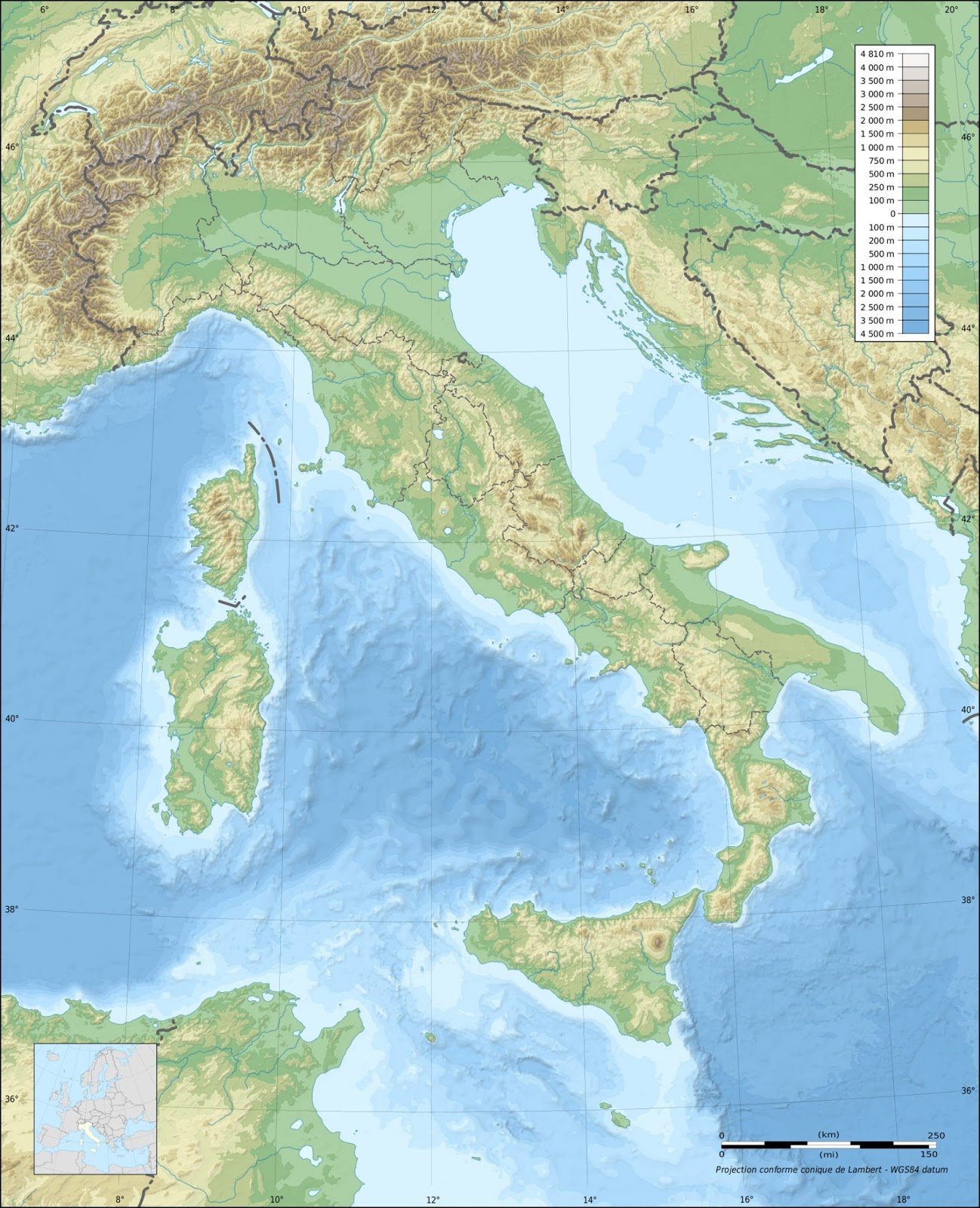
Italy’s shape, climate, and landforms have been greatly influenced by its unique location. It is encased by the Mediterranean Sea in the south, the Swiss Alps act as a natural border in the north, and it happens to be lie by a convergent plate interaction. Over time all of these have contributed to the look and feel of present day Italy. The Mediterranean Sea has helped to keep most of Italy in a Mediterranean climate, which has warm dry summers and cool wet winters. The Alps dominate the north and because of receding glaciers in the Swiss Alps, the country may be the new owner of the Matterhorn, the highest peak in the mountain range. (edition.cnn.com) The plate interaction just southwest of the country has help make some distinguishable landscapes all around the southern part of the country. With many of Europe’s volcanoes in Italy, one stands above the rest, the famous Mt. Vesuvius. It’s unforgettable shape and perfect climate make it one of the worlds unforgettable countries.

Italy in 1,000 years
Taken in 2008 the picture illustrates the
problem Venice is already facing.
If a solution is not presented the city will
drown. Photo credit:
http://ocean.nationalgeographic.com/ocean/critical
-issues-sea-level-rise/
The country of Italy is facing the burden of rising sea levels and can be witnessed in the town of Venice. According to the National Geographic, “Core samples, tide gauge readings, and, most recently, satellite measurements tell us that over the past century, the Global Mean Sea Level (GMSL) has risen by 4 to 8 inches (10 to 20 centimeters). This is alarming because the town of Venice is also sinking into the ocean. With the land that the town sits on going under and the sea level raising at an exponential rate, the city must devise a plan or go under. Venice has already experienced many floods that have drowned the city and the towns’ people just
fear that the next big flood is on its way.  In 1,000 years it is reasonable to say that the sea level will have risen approximately 60in. if not more due to the increase in human activity and global warming. (60 in. = 4in +8in/2 =6in per 100 yrs. 6inx10centries=60in.) This would be enough to completely wipe out the city of Venice, and change many physical features of some of Italy’s prized costal cities like Sardinia, Amalfi, Pisa, and many others.

10,000 Years later

The main cause of destruction or demise to Italy’s landscape and climate is going to be the tectonic plate movement and rising temperature globally. 10,000 years from now the country will look much different than it does today. As mentioned early it is already going to see a change in its board because of melting glaciers in the Alps. If run off from a mountaintop is supposed to flow towards sea that only leaves the water one place to go, towards Italy. In 10,000 years if the temperatures continue to rise the glaciers will recede even more flooding parts of the country and possibly creating more lakes. The costal towns that are already being affected by global warming and rising sea levels already will only have remnants of them. The size of Italy’s land size will also become smaller because of the sea rise.

The photo depicts what the landform
of Italy will look like in 1,000 10,000 and
1,000,000 years. The shaded area is the
land mass that is predicted to be
underwater during the passing times.
It was calculated by taking the past 100 average
sea rising levels. 
1,000,000 years from now
If the climate changes continue at the pace they are now, I could predict that the Island of Capri and Sardinia will have completely submerged and created some sort of archipelago, like the ones we see today. As we learned in a lecture an archipelago is formed when a land mass is eroded and becomes submerged. The top of the landmass falls like a caldera, and a ring of landforms are slightly submerged or sticking up out of the water.

I have included a drawing of what I expect for Italy to look like in the next 1,000,000 years and in between. I based my thoughts on the rate of change (temperature rising, plate interaction, and general ideas) as to how the country would be affected. The main idea is that it would be smaller and have more lakes because of the rising sea level and warmer temperatures causing glaciers to melt.


Reference:
National geographic-http://ocean.nationalgeographic.com/ocean/critical-issues-sea-level-rise/

Thursday, April 18, 2013

Figure 1.This is one of the modified Koopen Classification that can be
used when trying to determine the climate of a specific place. The
classification system 
was made by german botanist Waldimir Koppen.
Pic credit:(
http://www.fas.org/irp/imint/docs/rst/Sect14/Sect14_1d.html)

Italy's Climate 

Italy’s borders touch as far south as the Mediterranean and as far north as the Alpine mountain range. Although its climate is dominated by a Mediterranean climate the vastness of the country offers many different climates as we can look up in the Koppen scale. As defined by the Britannica website, “Köppen’s classification is based on a subdivision of terrestrial climates into five major types, which are represented by the capital letters A, B, C, D, and E. Each of these climate types except for B is defined by temperature criteria. These are subdivided, with additional letters again used to designate the various subtypes. Type A climates (the warmest), Type E climates (the coldest) are conventionally separated into tundra The mid-latitude C and D climates are given a second letter, f (no dry season), w (winter dry), or s (summer dry), and a third symbol (a, b, c, or d [the last subclass exists only for D climates]), indicating the warmth of the summer or the coldness of the winter. 
Figure 2. This is an average temperature chart of Palmero
over a 4 year period. It was used to help estimate the Koppen
climate. Pic credit: http://www.knowital.com/weather/sicily/
Palmero, Sicily, for example, coldest month drops right around 17-18 degrees Celsius, putting it in the "C" category in the Koppen scale. It does not rain much or at all during the summer so it could be placed in the "s"  sub category. As far as the warmest time of the year it is above 22 degrees Celsius, so could be considered a "Csa" in the Koppen classification system! (all information gathered was from figure 2).

Soil

With Italy stretching so far north and its elevation changing so much it has the perfect conditions to harbor some of the best soils to make wine!  Italy, produces almost 25 percent of the worlds wine and it is because of the perfect conditions( humidity, elevation, soil content) that are found in the Tuscan region of the country. Tuscany occupies 22,933 sq km of the Italian peninsula, where much fo the landscape are rolling hills. There are 64,000 hectares (160,000 acres) of vineyards nestled among these hills.(verticulture) The areas soil is composed of the perfect combinations of, calcium-carbonate, clay, sandstone, and iron. 

References
Britannic- http://www.britannica.com/EBchecked/topic/322068/Koppen-climate-classification
Verticulture- http://www.discovering-wine.com/scenes.html 

Tuesday, March 12, 2013

This topographic map show the mountain ranges that lie in the
 Italian boarder. The darker brown in the top-center
shows the Alp Mountain range and the Dolomites. Photo credithttp://mapsof.net/map/italy-topographic-map-blank#.UT-Dc9Ejp_k 
Italy’s northern landscape is dominated be the Alps mountain range. The area bounded inside the Italian boarder is known as the dolomites. They are worldly recognized not only by tourist, looking for a stunning backdrop, but by the scientific community that studies the geomorphologies of the world. The extension of the mountain chain is created by the deformation process that has been taking place over thousands of years. The process involves a long period of time and weathering as described be the architect Le Corbusier, “After the uplift and the consequent emerging from the sea, the Dolomite reliefs were sculpted and modelled through millennia by atmospheric agents, the force of gravity, running waters and ice which all contributed to transform them into the most beautiful work of architecture in the world, as Le Corbusier remarked.”(Geology of the Dolomites) It is significant to the geomorphology world, because it is a mountain range that has many landscapes that are due to glaciers, tectonic plate movements, and time.
The dramatic landscapes pleases anyone who encounters it, but to
the geologist of the world it shows it is much bigger than just a pretty
picture. It shows how weathering and a lot of time,can create such beautiful
vertical landscapes.

Cararra Marble quarry in Italy. Picture credit:
http://pcgladiator.blogspot.com/2009/03/marble-quarries.html
Italy is also know for its beautiful marble. Marble is created most of the time near mountain ranges and the topographic map above illustrates that Italy also has smaller mountain ranges running down the middle of the country. This type of landscape can sometimes be a result of a plate on plate collision. The process of two massive continents coming together supplies so much pressure that is needed to create marble. Cararra Marble is from the Tuscan region of Italy.This quarry seems to have an unlimited amount of marble, because it was also used during ancient times and was the choice of marble for the architect Michael Angelo.
The statue of "David" by Michael Angelo was made from marble
that was from the Cararra Quarry. It stand almost 17ft tall and it is almost hard
to imagine how big the block of marble must had been to crate this. Photo credit: Saul Hernandez
References: 
" Geology of the Dolomites".Alfonso Bosellini, Piero Gianolla, and Marco Stefani. March 2012. http://www.colletts.co.uk/factsheets/geology.pdf